Rustrel
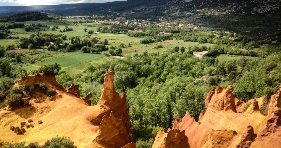
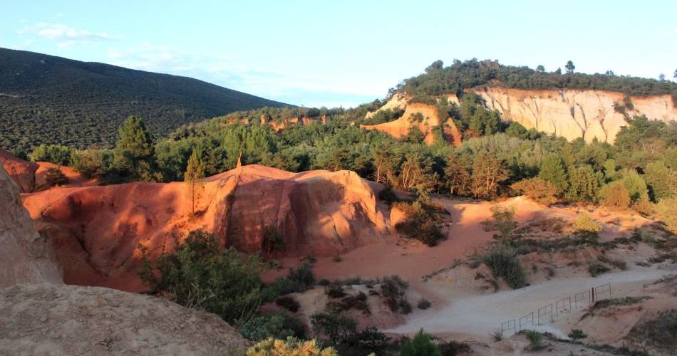
The Provençal Colorado


Tourist service in Rustrel :
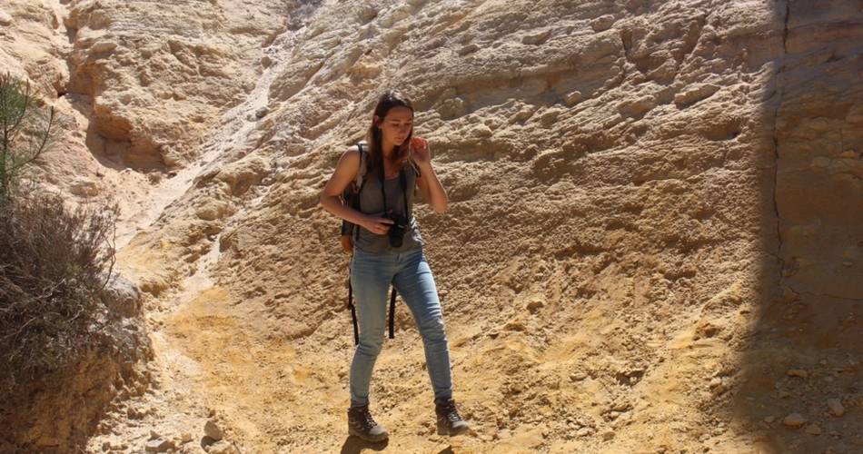
A break in the vast ocher gathering, both intimate and panoramic.
Facing the Restreou Hostel, take the Route de Saint-Christol (D30) to the right. 100m further, turn right and go down the Boulevard du Colorado (D30a). 430m further, take the Chemin de Saint-Joseph to the right and follow it. At the stop sign, cross the D22 (be careful!) and continue across. At the crossroads "Cornet", turn left. Then follow the old car park of Colorado. In a curve (refreshment area), immerse to the right on the DFCI track. Cross the Dôa (ford) and go up the long track of Barriès (GR® markings).
1- At the sign-post ''Barriès'' turn left onto the pretty trail (slab). Reach an area of ruts and continue straight (GR®). Then take the paved road "Chemin de l'Ubac". At the junction, go right onto Route de Gignac.
2- At the mountain pass, take the left track for 500m and reach the imprinted slabs. Turn around and go back to point 2. Back again on the pass, follow the road to the left. At the crossroads "Pradenques" and "Ubac de Pradenques" continue straight. On top of the hill, turn onto the right track. 1km away, take a right back into the woods. After a break, continue left onto the lower trail (PR). Go along a large field and reach the crossroads ''Croix de Christol '' (sign-post).
3- Pass the gate and hurtle down the trail (PR). The stones give way to ocher; take the time to make a landscape stop. Down, spin slightly to the left along the clearing, fording the Dôa, past the sewage treatment plant and reach the hamlet of Istrane.
4- Turn right and take small road. Skip two curves, go along a house and at the next intersection on the corner of a farm, turn left. Go up the small road. Cross the D22 (be careful!) and continue across. Pass the school parking lots and reach the center of the village of Rustrel.
Contact
The Provençal Colorado84400 Rustrel
Downloads