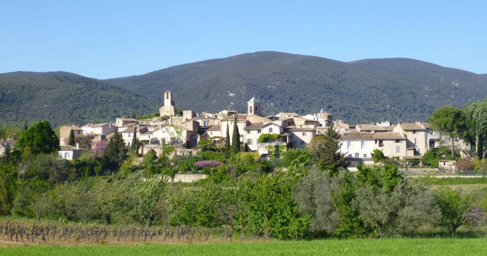
Cadenet
Rando : d'un château à l'autre, de Cadenet à Lourmarin
Tourist service in Cadenet :
From Cadenet to Lourmarin, around the Gardis hill, vineyards in vineyards. An itinerary offering beautiful views of the Grand Luberon, the Durance Valley, the valley of Aigues, the Alpilles and the Sainte Victoire.
HIKING DESCRIPTION
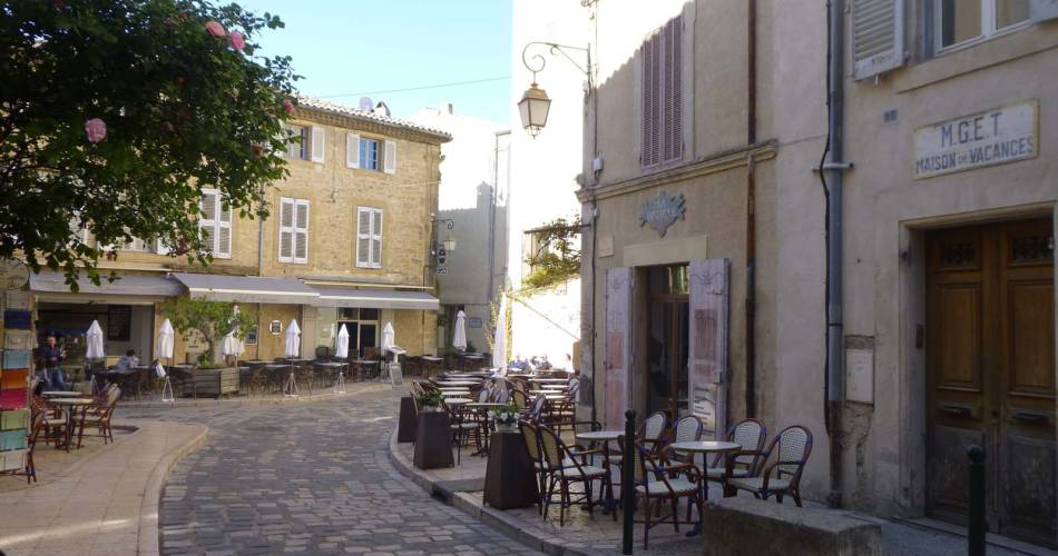
Go down the parking lot to the cemetery. Turn right and follow the Cours Voltaire. Pass in front of the Saint-Etienne church, and the Hôtel-Dieu to join the Place du Tambour d'Arcole.
1 - From the tourist office, turn to the left, turn right into the Viala street. After a few meters, climb the stairs on the left and the Place de la Fontaine Fabre. Turn left onto Rue du Tambour d'Arcole. Go past the birthplace of André Estienne. On the small square, slip on the right in the turning street. Go up to the left, rue Béranger. Turn left onto Rue Raspail.
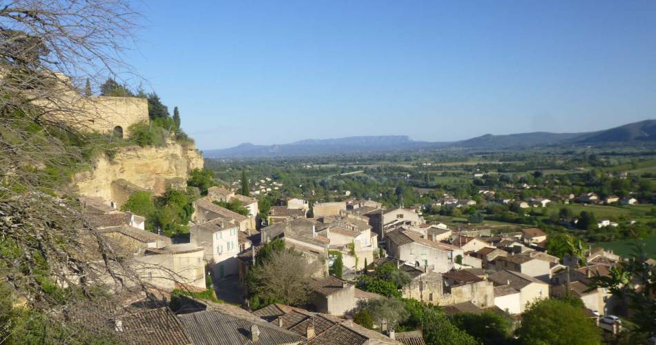
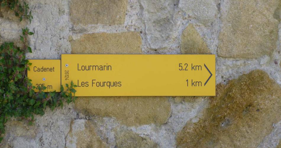
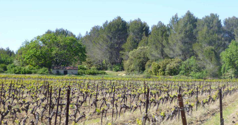
2 - Follow the direction Lourmarin, Les Fourques indicated by the hiking sign in front of the wash house. And follow the yellow markup from this point. Opposite, from the wash-house the entrance of an old convent of the XVIIth century. Continue straight on rue Marceau (the road on the left brings you to the ruins of the castle of Cadenet). Turn right towards the parking site of the castle, then follow the direction Tutiers, then the Pastras. Along the way, many views of the Grand Luberon.
3 - At the intersection the Fourques take direction Lourmarin / Coulongue. In the first turn, on the right climb a stony path. Continue left on the road. A few meters after passing an entrance gate with a cypress turn left between the vineyards, along the hedge and continue straight. In a curve leading to a construction, sneak through the vegetation to descend a stony path. After this wooded road, continue to the left in the direction of the house.
4 - At the intersection Coulongue, take the direction Lourmarin / Saint-André. Walk for 1 km to reach the Saint-André intersection, take the direction of Lourmarin / La Paccarde on the Chemin de Gayet. Continue left on the Chemin du Gayet. At the end, sneak on the small path on the right.
5 - At the intersection of la Paccarde, at the roundabout, take the street in front of Rue Henri de Savornin to Place de l'Ormeau.
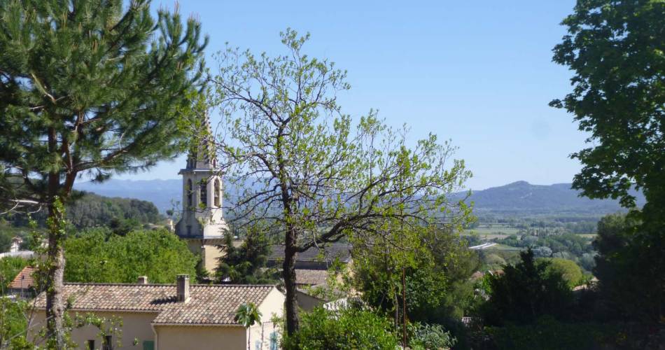
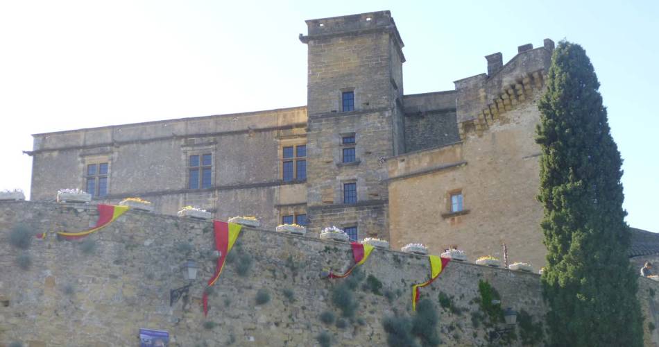
(The marking stops to start at the castle) Turn left into the street of the temple to reach the square of the same name. Continue towards the temple and the castle. At the intersection Lourmarin the castle take the direction Cadenet the castle. At Calvary, beautiful view of the village. Cross the D27 (Be careful!) To continue on Lautin's draille. Along the way, turn around for a view of the castle of Lourmarin.
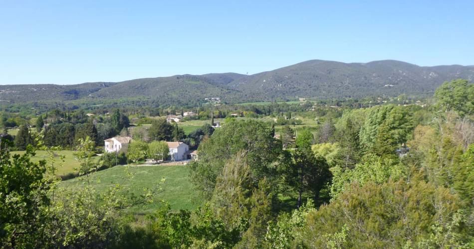
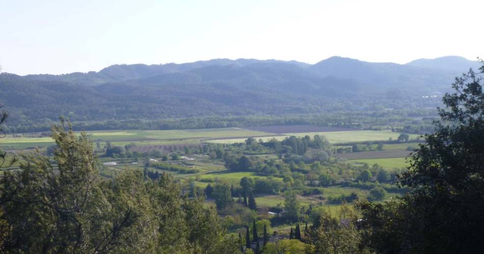
6 - At the end of the road, turn right and follow the D943 for 100 m (Be careful!). Cross the road to join Balerys Road. After a habitation at the Y, take a right on a balcony trail above the valley offering a beautiful panorama over the Durance valley, from the ridges of the Sainte Victoire to the Alpilles. At the Y take right on a path that goes down. Notice on the left of the small caves dug in the tuff, a little further, a view on the site of the castle and the village below. Continue downhill until you reach the village.
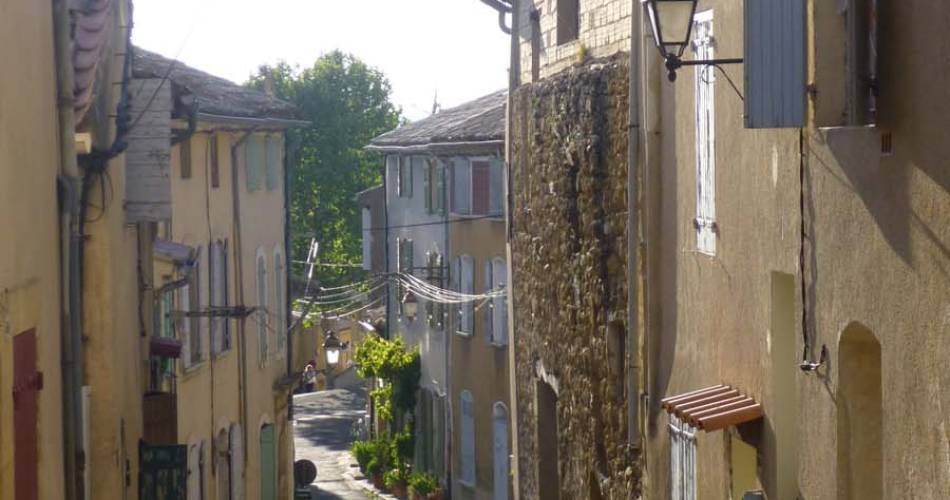
7 - At the intersection Cadenet the castle, turn left onto Ledru Rollin street. Descend towards the village center, at the stop sign turn left into the street of 8 May 1945. Turn left and continue to the foot of the belfry. Turn right on the rue Victor Hugo, a few meters further on the right you will see the Place du 14 juillet and its large fountain. Unblock on the Drum of Arcole square. Take the Voltaire course on the left to reach the car park.
Go down the parking lot to the cemetery. Turn right and follow the Cours Voltaire. Pass in front of the Saint-Etienne church, and the Hôtel-Dieu to join the Place du Tambour d'Arcole.
1 - From the tourist office, turn to the left, turn right into the Viala street. After a few meters, climb the stairs on the left and the Place de la Fontaine Fabre. Turn left onto Rue du Tambour d'Arcole. Go past the birthplace of André Estienne. On the small square, slip on the right in the turning street. Go up to the left, rue Béranger. Turn left onto Rue Raspail.
2 - Follow the direction Lourmarin, Les Fourques indicated by the hiking sign in front of the wash house. And follow the yellow markup from this point. Opposite, from the wash-house the entrance of an old convent of the XVIIth century. Continue straight on rue Marceau (the road on the left brings you to the ruins of the castle of Cadenet). Turn right towards the parking site of the castle, then follow the direction Tutiers, then the Pastras. Along the way, many views of the Grand Luberon.
3 - At the intersection the Fourques take direction Lourmarin / Coulongue. In the first turn, on the right climb a stony path. Continue left on the road. A few meters after passing an entrance gate with a cypress turn left between the vineyards, along the hedge and continue straight. In a curve leading to a construction, sneak through the vegetation to descend a stony path. After this wooded road, continue to the left in the direction of the house.
4 - At the intersection Coulongue, take the direction Lourmarin / Saint-André. Walk for 1 km to reach the Saint-André intersection, take the direction of Lourmarin / La Paccarde on the Chemin de Gayet. Continue left on the Chemin du Gayet. At the end, sneak on the small path on the right.
5 - At the intersection of la Paccarde, at the roundabout, take the street in front of Rue Henri de Savornin to Place de l'Ormeau.
(The marking stops to start at the castle) Turn left into the street of the temple to reach the square of the same name. Continue towards the temple and the castle. At the intersection Lourmarin the castle take the direction Cadenet the castle. At Calvary, beautiful view of the village. Cross the D27 (Be careful!) To continue on Lautin's draille. Along the way, turn around for a view of the castle of Lourmarin.
6 - At the end of the road, turn right and follow the D943 for 100 m (Be careful!). Cross the road to join Balerys Road. After a habitation at the Y, take a right on a balcony trail above the valley offering a beautiful panorama over the Durance valley, from the ridges of the Sainte Victoire to the Alpilles. At the Y take right on a path that goes down. Notice on the left of the small caves dug in the tuff, a little further, a view on the site of the castle and the village below. Continue downhill until you reach the village.
7 - At the intersection Cadenet the castle, turn left onto Ledru Rollin street. Descend towards the village center, at the stop sign turn left into the street of 8 May 1945. Turn left and continue to the foot of the belfry. Turn right on the rue Victor Hugo, a few meters further on the right you will see the Place du 14 juillet and its large fountain. Unblock on the Drum of Arcole square. Take the Voltaire course on the left to reach the car park.
Equipment
- Picnic area
- Public WC
Services
- Pets welcome
- Accommodation
- Restaurant
Dates and times
All year round.
Duration: 3 h
Prices
Free access.
Contact
Rando : d'un château à l'autre, de Cadenet à Lourmarin11 place du Tambour d'Arcole
84160 Cadenet