Bonnieux
The Portalas trail
Route
Loop
Difficulty
Very easy
Duration
2h
Distance
3km
Positive elevation gain
82 meters
Negative elevation gain
82 meters
Altitude
Min. 628 meters
Max. 708 meters
- circuit
- variante
- liaison
Departure / Arrival
Bonnieux - Parking des Cèdres du Petit Luberon /
Parking
Parking des Cèdres du Petit Luberon
profil altimétrique
Tourist service in Bonnieux :
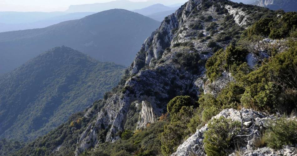
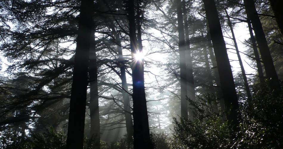
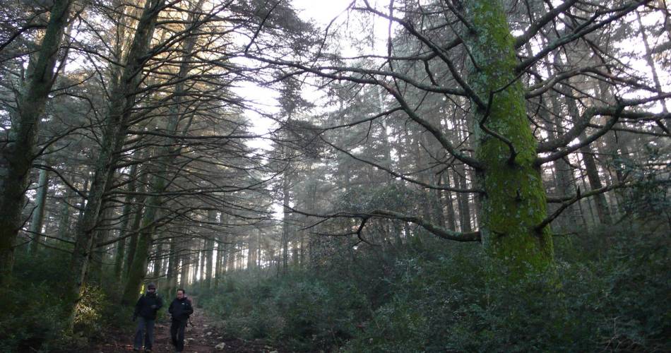
A magical immersion in the cedar forest, wandering the heart ofthe scrubland and panoramic contemplation on the south of the Luberon ...
Go to the far end of the car park, cross the barrier by the dedicated pedestrian crossing and reach the welcome sign. Continue a few metres to reach to the starting area of the Portalas trail.
1 - Go to the left on the Portalas trail, yellow arrow. Continue about thirty metres on the itinerary accessible to people with disabilities and take a right at the labyrinth and its maze of decking. Come a little further back on the main route and regain the area of interpretation on pastoralism. Exit the "Chemin des Cèdres" trail to take the path on the left. 20m further, turn right and go down slowly to the shaded valley. After the well-marked left hand turn, continue descending for 600m. Upon arriving at a coal production site (point 623), leave the valley and take a right on a winding path.
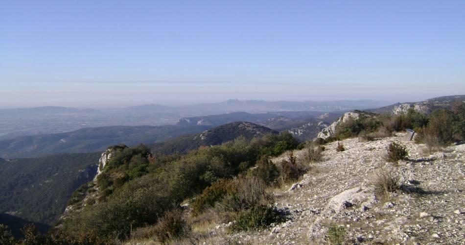
2 - At the crossroads "Le Portalas", turn right. Continue on the path between boxwoods and oaks. Just after a rocky ledge, turn left and climb a steep path to reach the edge of the plateau and its panoramic view.
3 - Continue straight on the plateau and 70m further, turn right. Follow the path that goes into the woods. Continue straight until the paved forest path.
4 - At the crossroads "Bois Roustan” turn right and follow the forest track to return to the car park.
Alternative route for the return: from the crossroads "Bois Roustan" (point 4), return to the car park following in the opposite direction the "Chemin des Cèdres" trail that winds through the woods behind the interpretation area "Forest exploited by man".
1 - Go to the left on the Portalas trail, yellow arrow. Continue about thirty metres on the itinerary accessible to people with disabilities and take a right at the labyrinth and its maze of decking. Come a little further back on the main route and regain the area of interpretation on pastoralism. Exit the "Chemin des Cèdres" trail to take the path on the left. 20m further, turn right and go down slowly to the shaded valley. After the well-marked left hand turn, continue descending for 600m. Upon arriving at a coal production site (point 623), leave the valley and take a right on a winding path.
2 - At the crossroads "Le Portalas", turn right. Continue on the path between boxwoods and oaks. Just after a rocky ledge, turn left and climb a steep path to reach the edge of the plateau and its panoramic view.
3 - Continue straight on the plateau and 70m further, turn right. Follow the path that goes into the woods. Continue straight until the paved forest path.
4 - At the crossroads "Bois Roustan” turn right and follow the forest track to return to the car park.
Alternative route for the return: from the crossroads "Bois Roustan" (point 4), return to the car park following in the opposite direction the "Chemin des Cèdres" trail that winds through the woods behind the interpretation area "Forest exploited by man".
recommended parking
Parking des Cèdres du Petit Luberon
To note
- Choose to do this hike in the autumn, winter and spring.
- Before leaving find out about the risk of wildfires. This itinerary is only open to the public in the afternoon in the event of a “very severe” risk of wildfires (closed if there is an “exceptional” risk).
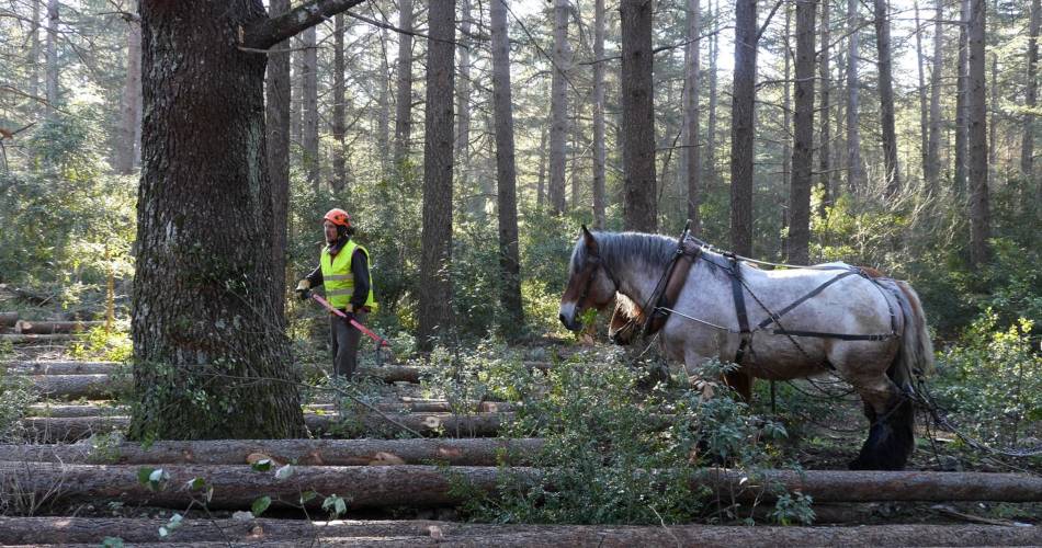
- Pastoral zone. Herds and flocks of animals in meadows, as well as sheepdogs. Remain calm.
- Rocky passages.
 If you want to report a problem on your hike (marking, maintenance, danger...), let us know on Suricate: sentinels.sportsdenature.fr
Access to the massifs
Respect the regulations preserving protected natural areas – find out about restrictions to accessing the massifs during fire risk periods, from 15 June to 15 September.
Before heading out, check the website
Respect the regulations preserving protected natural areas – find out about restrictions to accessing the massifs during fire risk periods, from 15 June to 15 September.
Before heading out, check the website
In brief
- A hike at the heart of the “magical” Cedar forest, alternating between shade, freshness, and dry and windy garrigue spaces.
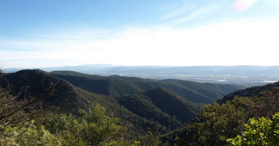
- Wide, open views of South Luberon.
- Viewing point on the floors of small wooded valleys, and the birds of prey living on the nearby rocks
Downloads